Shimla District
Shimla District
The history of present-day Shimla district cannot be reduced to the rise of Shimla town. Nor can the district be projected unchanged into the territories that a colonial Gazetteer grouped as the “Simla Hill States.” These are three connected but different frames: a modern administrative district, a town with a distinct colonial history, and multiple former hill states documented as separate units. The links among them were made through administrative changes whose dates and authorities must also remain distinct.
The available record is clearest when it is read in that order. A 1910-reference-year Gazetteer, printed in 1911, shows the plurality of the hill states in colonial documentation. The District Census Handbook retrospectively places 19 former Shimla Hill States in Himachal Pradesh and Mahasu district in 1948, while treating Shimla town separately. The Punjab Reorganisation Act supplies primary statutory evidence for the transfer of Punjab’s Simla district on 1 November 1966. The handbook then reports the present Shimla district as coming into existence through reorganisation on 1 September 1972. Together, these sources support a history of combination and changing jurisdiction, not timeless territorial continuity.
Key Takeaways
- Present Shimla district is not interchangeable with Shimla town. The town’s colonial role is one strand within a broader district history, not the origin story of every area now administered in the district.
- The former hill states were multiple documented units. The colonial Gazetteer’s contents distinguish Bashahr, Jubbal, Kumharsain, Keonthal and tributaries including Koti, and other states; that classification does not map their territories exactly onto the modern district.
- The 1948 change led to Mahasu, not directly to today’s district. The Census handbook says 19 former Shimla Hill States merged into Himachal Pradesh and became part of Mahasu district, alongside territories that followed other administrative routes.
- The 1966 transfer has a statutory basis. The Punjab Reorganisation Act transferred Punjab’s Simla district to the Union territory of Himachal Pradesh on 1 November 1966.
- The present district belongs to a separate 1972 account. The handbook dates its formation to 1 September 1972, but the underlying state order was not recovered and should not be invented.
Three Historical Frames, Not One
“Shimla” can identify related places and administrative ideas without giving them one continuous boundary. The district administration’s history page and the Census handbook both describe a composite district while giving the town its own treatment. The colonial Gazetteer uses “Simla Hill States” for a collection of political units. The 1966 Act, meanwhile, refers to a statutory Punjab district spelled “Simla.” Similar names do not erase the different jurisdictions, dates, and source types involved.
This distinction changes the shape of the narrative. A town-centred account would move from colonial Shimla directly to the present district, leaving former-state histories as background scenery. A boundary-centred account might instead treat every Gazetteer unit as though it fell wholly within today’s Shimla. Neither approach is supported. The record points to several predecessor jurisdictions that entered later arrangements through different routes.
Separate Hill States in the Archival Record
The contents and introduction of Punjab States Gazetteers, Volume VIII: Simla Hill States resist the idea of a single earlier Shimla polity. They distinguish Bashahr, Keonthal and its tributaries, including Koti, Jubbal and its tributaries, Kumharsain, and numerous other states. That documentary arrangement establishes plurality: colonial administrators encountered and described multiple units, not an undivided state corresponding to the current district.
The conclusion must stay within that evidence. A contents list can show separate documentary treatment, but it cannot by itself establish the complete political history of each state, the exact relationship among all of them, or their correspondence with a later district line. The Gazetteer’s “Simla Hill States” was a colonial administrative category. It reflects the purposes, priorities, spelling, and judgments of its period, and its degraded text makes unsupported detail especially unsafe.
For the same reason, the named states should not become pieces in a false map of present boundaries. Bashahr, Jubbal, Kumharsain, Keonthal, Koti, and the other units have value here as evidence of multiple jurisdictions. Their inclusion in one volume does not turn them into a federation, a kingdom, or an earlier version of Shimla district. The archive supplies a check against town-only history, but not a licence to reconstruct boundaries or political events that its inspected passages do not establish.
Shimla Town’s Bounded Colonial Strand
Shimla town has an important place in the record, but its history must be stated at town scale. The District Census Handbook says that the town became the formal summer seat of the Government of India in 1864. This supports a specific claim about a formal seasonal governmental role. It does not establish a year-round seat, and it should not be expanded into an unsupported account of settlement, land transactions, buildings, or daily administration.
Keeping the town strand bounded does not minimise its significance. It prevents a well-documented colonial centre from standing in for many other places and predecessor states. The 1864 statement belongs between the evidence of separate hill states and the later administrative sequence. It explains why town history is visible in district retrospectives without making the town the territorial source of the district.
1948: Former Hill States Enter Mahasu
The Census handbook describes the next administrative frame retrospectively. It says that the present district includes 19 former Shimla Hill States that merged into Himachal Pradesh in 1948 and were made part of Mahasu district. It also indicates that other territories incorporated into the present district followed other routes. The significance of 1948 is therefore integration into Himachal Pradesh and an arrangement within Mahasu, not the creation of today’s Shimla district.
That difference is easy to lose when later names are read backward. Mahasu district was not simply the present Shimla district under an older label, and the 19-state count should not be used to claim that every former unit had the same later administrative path or unchanged limits. The handbook supplies a composite thesis, but it is retrospective and cannot make boundaries fixed across time.
The underlying 1948 merger instruments were not recovered in the available record. No accession term, notification number, schedule, or exact local boundary can therefore be supplied from this account. The careful claim is both meaningful and limited: according to the handbook, 19 former Shimla Hill States entered Himachal Pradesh in 1948 and became part of Mahasu district. That arrangement provides a predecessor layer for the modern district without collapsing the former states into one earlier polity.
1 November 1966: The Statutory Simla Transfer
The Punjab Reorganisation Act, 1966 establishes a different change with primary legal evidence. Section 2(b) defines the appointed day as 1 November 1966. Section 5(1)(a) provides for the transfer of Punjab’s statutory “Simla” district, together with other named Punjab districts, to the Union territory of Himachal Pradesh. The historical spelling is relevant when describing the Act; the modern article otherwise uses Shimla.
This was not a second description of the 1948 hill-state integration. The subject of the statute was a Punjab district, whereas the handbook’s 1948 passage concerns former hill states placed in Mahasu. Nor did the Act itself create the present Shimla district on the date later reported for 1972. The statute supports the appointed day, the named territorial unit, and its destination. It does not supply the composition of the hill states, Shimla town’s colonial role, or the mechanism of the later district reorganisation.
Separating these events prevents a misleading shortcut in which “reorganisation” becomes one vague process. The 1948 account, the 1966 statute, and the 1972 handbook report answer different administrative questions. Only the middle event is established here through the text of the underlying legislation.
1 September 1972: The Handbook’s District Account
The District Census Handbook reports that the present Shimla district came into existence on 1 September 1972 through a state district reorganisation. Its account distinguishes territories retained with Shimla from Kandaghat and Nalagarh areas merged into Solan, and describes most of former Mahasu entering the new Shimla district subject to stated exclusions. This is the point at which the retrospective record identifies the present district as an administrative unit.
The account is informative without being complete legal proof. The underlying state order was not recovered, so its title, notification number, operative wording, and full territorial schedule cannot be reconstructed. “Came into existence” should remain attributed to the handbook, rather than being presented as a quotation from an unseen instrument. The territorial paraphrase should likewise remain at the level the handbook supports.
The 1972 formation did not make earlier jurisdictions equivalent to the resulting district. Former hill states, Mahasu, the Punjab district transferred in 1966, and the present district were different administrative shapes. Later changes also cannot be ruled out merely because the handbook describes a formation date. The safe historical sequence is one of successive arrangements, with boundary equivalence neither assumed nor claimed.
One Protected Entry, Narrow Evidence
The Archaeological Survey of India’s inventory lists “Vice Regal Lodge (Rashtrapati Niwas)” — Shimla — Shimla as a centrally protected entry. That row gives a formal inventory name, locality, district label, and protected status. It is material evidence of listing, not a full building history.
Nothing in the inspected row establishes when the building was constructed, who designed or occupied it, how its institutional role changed, what it is used for now, its condition, ownership, or whether the public may enter. Those familiar kinds of heritage detail require separate evidence. The inventory also cannot be used to enlarge the handbook’s 1864 town statement or prove a district boundary.
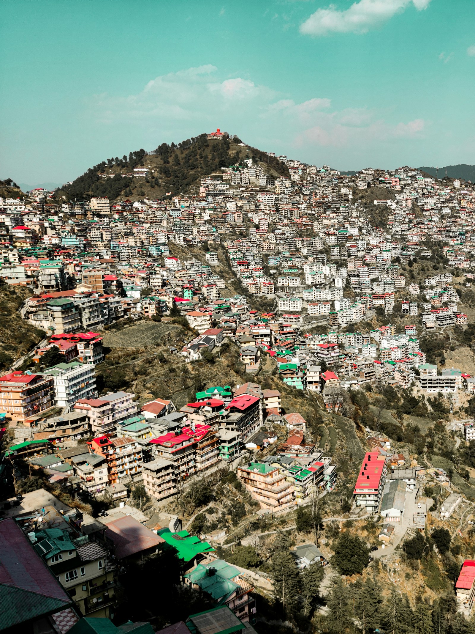
The accompanying photograph has a similarly narrow role. Its present-day view of Sanjauli provides geographic context, but neither its pixels nor its metadata establish a historical event, a former-state jurisdiction, or a modern district line. Image attribution documents authorship and licensing; it does not create historical evidence.
Reading Shimla’s Layered Past
Shimla district’s history is strongest when administrative difference remains visible. The archival Gazetteer documents multiple hill states through colonial categories. The handbook distinguishes the town’s 1864 role, the 1948 Mahasu arrangement, and the district formation it reports for 1972. The 1966 Act independently establishes the statutory transfer of Punjab’s Simla district on its appointed day. The ASI list contributes one protected inventory entry and nothing beyond that status.
This record leaves important matters unresolved. It does not provide a continuous history of every former state, exact historical boundaries, the primary 1948 merger instruments, or the underlying 1972 order. It does not justify folklore as etymology, colonial social judgments as neutral description, or architectural detail inferred from an inventory. Those are not gaps to fill with a smoother story.
What remains is a more defensible thesis. Present Shimla district emerged from distinct jurisdictions and successive administrative decisions; it was not the automatic territorial extension of Shimla town, and it was not an unchanged continuation of the former Simla Hill States. The town’s colonial strand, the states’ documentary plurality, the Mahasu arrangement, the statutory 1966 transfer, and the handbook-reported 1972 reorganisation belong in one history only when their differences are preserved.
Frequently Asked Questions
Is Shimla town's colonial history the history of the whole district?
No. The handbook's 1864 summer-seat account concerns Shimla town. The modern district also includes territories linked to separately documented hill states and later Mahasu, Punjab, and Himachal Pradesh reorganizations.
What does the source record show about the Shimla Hill States?
The colonial Gazetteer's contents treat Bashahr, Jubbal, Kumharsain, Keonthal and Koti, and other states as distinct documentary units. That does not prove exact overlap with the present district or one historic polity.
What happened to former Shimla Hill States in 1948?
The 2011 handbook reports that 19 former Shimla Hill States entered Himachal Pradesh in 1948 and became part of Mahasu district. Because the underlying instruments were not recovered, the count and administrative effect remain attributed to the retrospective handbook.
What changed in 1966 and 1972?
On 1 November 1966, the Punjab Reorganisation Act transferred the existing Punjab district spelled Simla to Himachal Pradesh. The handbook separately says the present Shimla district came into existence on 1 September 1972.
What does ASI establish about the Vice Regal Lodge?
ASI's inventory establishes only that “Vice Regal Lodge (Rashtrapati Niwas)” at Shimla appears as a centrally protected entry. It does not establish the building's date, architect, occupants, later institutions, current use, condition, ownership, or access.